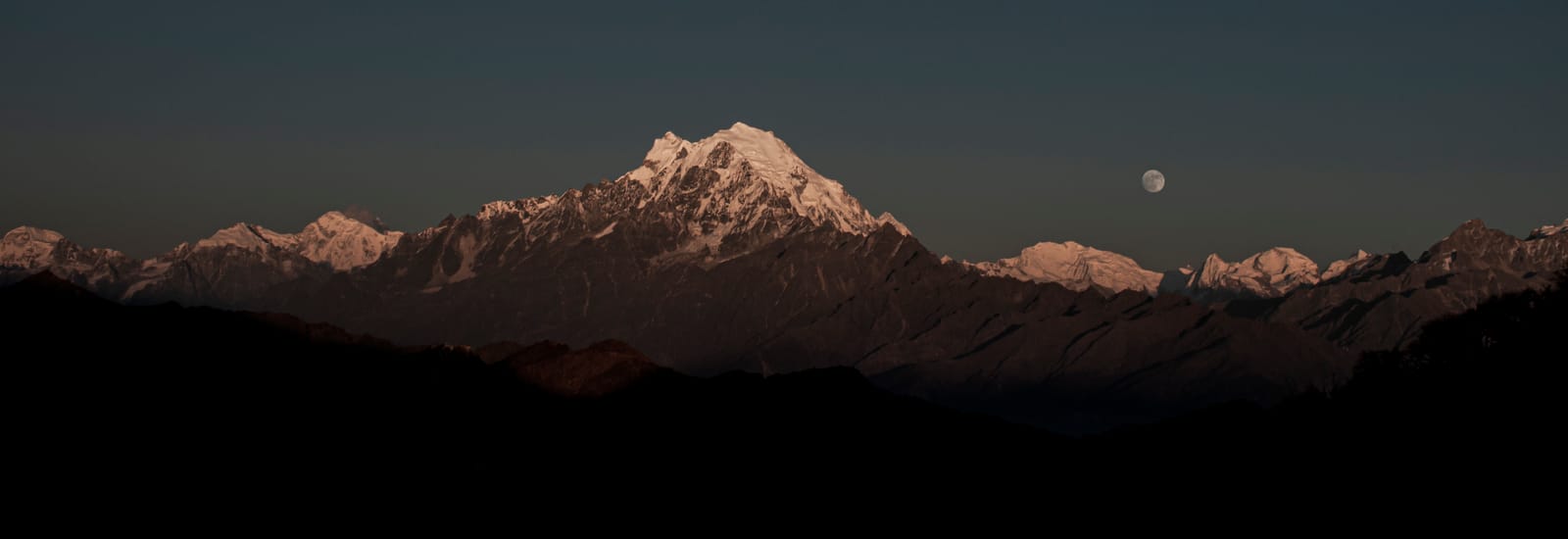
On the morning of 26 August, a mass of ice and rock came away from the glacier beneath Langtang Lirung and dropped into the bed of the Lhende Khola. It dammed the river, a lake gathered behind the blockage, and when the blockage failed the whole of it went down the narrow Bhote Koshi valley and on into the Trishuli as a moving wall of water, mud and boulders. Villages, bridges, hydropower plants, the customs post and the only road to Tibet were gone inside a few minutes.
I live in Pokhara, roughly a hundred kilometres from that valley. Since that morning I have answered one question, over and over, from travellers and agents and journalists in a dozen countries: should I still come to Nepal this autumn?
Yes. And I would rather give you the reasoning than the reassurance.
Last checked: 16 October 2026. Since 17 September the Kathmandu–Pokhara road has been open again, Langtang is gradually reopening, and on 11 October a new and separate flood struck the Manaslu valley. The figures below are dated, and I keep this page current as the picture changes.What happened on 26 August
Rasuwa is the district directly north of Kathmandu, pressed up against the Tibetan border. For travellers it has always meant two things: the way into the Langtang valley, and the Rasuwagadhi–Kerung crossing, through which thousands of pilgrims pass every year on their way to Mount Kailash. Both are now inside a disaster zone.
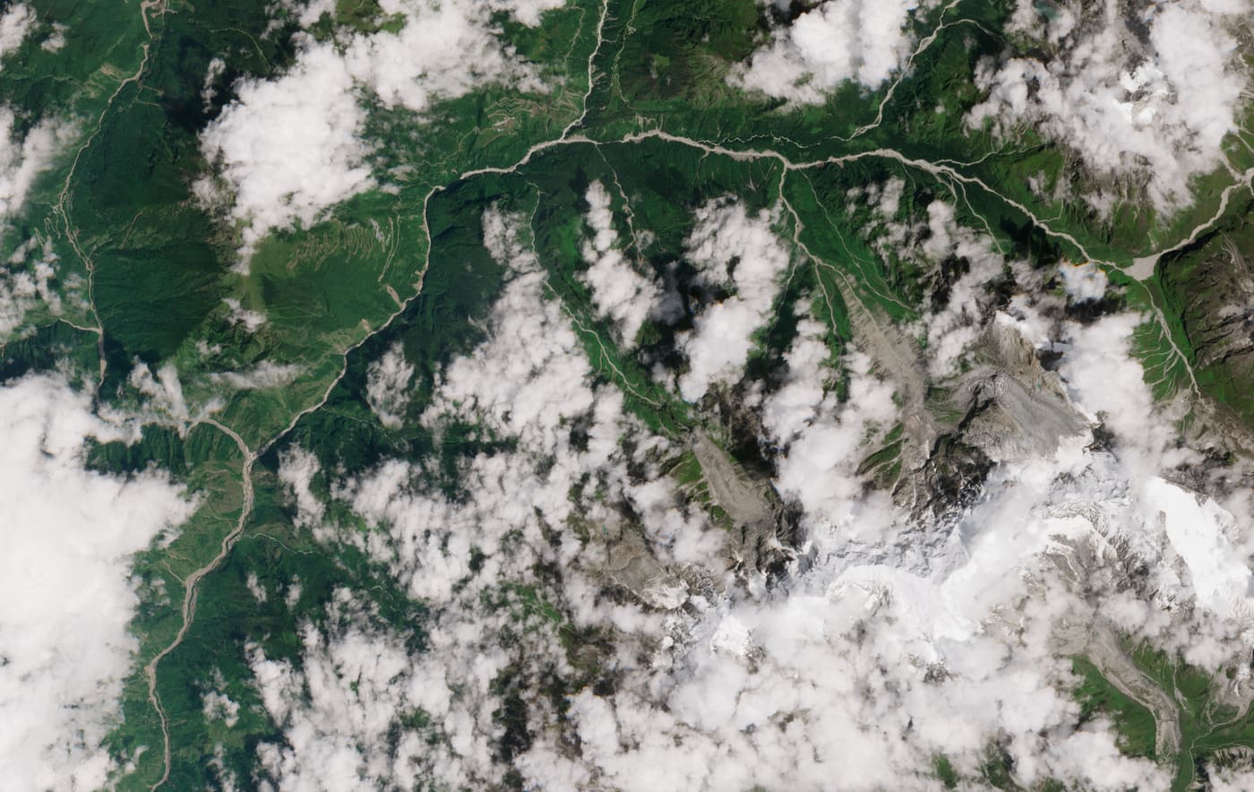
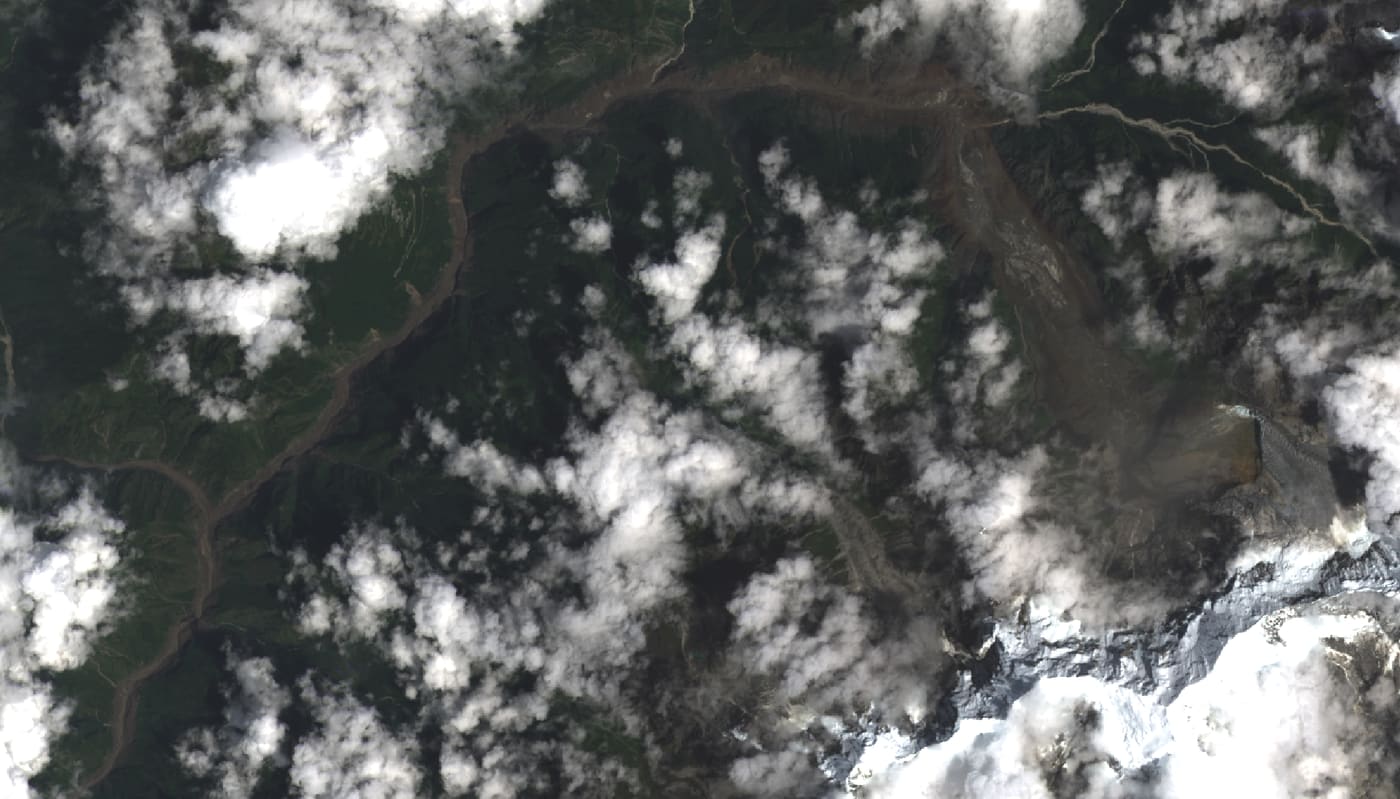
The geologists who have read the seismic record describe one very large detachment from the glacier below Langtang Lirung, a peak of 7,234 metres. What came off it landed in the Lhende Khola and stopped the river. The lake that formed behind the debris held for a time, and then it did not. Timure, Rasuwagadhi and Syabrubesi were struck first — Syabrubesi being the village from which every Langtang trek has ever set out. The flood carried on downstream through Nuwakot, Dhading, Gorkha, Tanahun and Chitwan. On the far side of the border, the Gyirong customs post is simply no longer there.
Two satellite passes, forty-eight hours apart, describe it better than I can.
The numbers, checked 16 October
These are the latest official figures available on 16 October. They are still provisional, and different agencies still count differently.
- More than 1,400 people have died and more than 5,200 remain missing in Nepal, according to the NDRRMA as reported on 15 October. The consolidated toll stood at 1,454 dead and 5,285 missing on 4 October, and UNICEF counts at least 84 children among the dead. DNA has been taken from more than 1,300 bodies. Since 9 October the authority has been formally registering the missing, so that they can be declared dead and their families can receive relief of 200,000 rupees.
- 636 foreign nationals are among the missing, on government figures of 15 October, most of them pilgrims who were on their way to Kailash. Their cases are now being verified through the embassies. The most recent consular confirmation available to this article is dated 2 September; at that point, as far as I know, there was no Greek or Cypriot name on the list. It is revised continually.
- The World Health Organization counts roughly 10,000 households in need of immediate assistance. Three health centres have been lost entirely, and a hospital is partly destroyed.
- Fifteen municipalities have been declared disaster zones for three months, and more than 21,000 soldiers, police officers and rescue workers are deployed.
- 55 kilometres of road, 33 motorable bridges and 68 suspension bridges are gone, along with 7,570 houses; 18 schools and seven health facilities are damaged or destroyed, according to the NDRRMA tally of 4 September. The single road that led to Rasuwagadhi and the Tibetan border no longer exists.
- On 11 October a separate flood came down the Budhi Gandaki in Gorkha, the Manaslu valley. An ice and rock landslide high on the mountain briefly dammed the river. Five people are missing, more than 200 homes and several bridges are gone, and the army airlifted more than 300 people out, foreign trekkers among them. No deaths have been reported.
What I saw from Pokhara
Nothing. That is the part I need you to understand first.
Here in Pokhara, where I live with my family, not one drop of rain fell beyond the ordinary monsoon. Phewa Lake was flat. The shops along Lakeside were open. The domestic flights went out on schedule. A hundred kilometres away a valley was being erased, and the town I was standing in was having an unremarkable Wednesday. That distance is the single most important fact in this article, and it is the one that never survives a news bulletin.
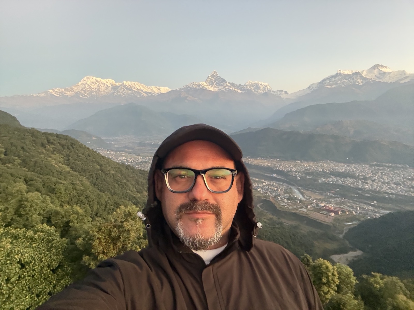
What did not stay quiet was my telephone. From nine that morning it did not stop: friends in Greece, families of travellers, the Greek Embassy in New Delhi, and then the newsrooms.
That same night, close to ten o'clock, with the live feeds from Rasuwa in front of me, I told Newsbomb: "The torrent has now started, little by little, to calm down. It is about 22:00 here in Nepal and we can see the water level beginning to drop."
The following day, 27 August, I tried on ERT, Greece's public broadcaster, to explain why this was not another monsoon flood. "An entire mountain left, it turned into water and it took everything." And, because the scale of it had not landed yet: "An enormous disaster has happened. People have not yet realised what has taken place." And: "Nepal is used to small-scale landslides. A hillside goes, it takes five houses, a bit of a village. This is an unprecedented phenomenon." About the border road, there was nothing to soften: "The only road you could take was destroyed, it no longer exists." Asked what it meant for the country, I said it could set Nepal "20 years back", and I meant it.
Earlier, speaking on Alpha TV in an interview carried by CNN Greece, I had already had to say the sentence I least wanted to say on air: "Here they are talking about thousands of dead, there is no Greek on the list."
But the line I keep returning to is the quieter one I gave ERT, because it is the part almost nobody outside Nepal is thinking about: "It is not only that many people will be lost, it is also a terrible economic disaster for this land."
Tourism accounts for 6.6 percent of this country's economy, and autumn is the quarter the entire mountain economy lives on. The former head of the Nepal Tourism Board has already warned that the damage to tourism will run for six to seven months at least. That is the whole season. And the whole season is what pays for the winter.
There is a plainer line I gave ERT the same day, and it is the one I would keep if I could keep only one: "We see the mountains here; we live with them, and from them." They are the first thing in my window every morning. That is how I know what the coming six months will cost the people around me, and it is why I am writing to you.
Why coming is the help that lasts
I have watched this film before, and I would like it to end differently this time.
After the 2015 earthquake, the world saw the footage and cancelled. Arrivals fell by roughly a third in the year Nepal needed them most. The donations came, and they mattered enormously, and they were spent. What did not arrive was the ordinary economy: the guide with work in October, the four-room lodge with someone in it, the porter who is paid at the end of the week and buys school shoes with it.
Think about where the money for a journey actually goes in a country like this one. It does not enter a fund and it does not pass through a foundation. It goes to the guide, the porter, the driver, the cook, the family that owns the lodge on the ridge, the woman selling apples where the trail turns. From there it goes into their villages, their schools and their pharmacies, more or less immediately. A single group arriving in October is a winter for several households, and no one has to apply for it.
There is also the part that does not appear in any ledger. When you travel to a country in the middle of its grief, you are telling it that it has not been written off. Nepalis remember that. They remember it for decades, and they will tell you about it twenty years later on a trail.
So, plainly: I am not asking you to go to Rasuwa. Rasuwa is closed, and it should be. I am asking you not to cancel Everest, Annapurna, Pokhara, Kathmandu or Chitwan because of an image from a valley that sits tens or hundreds of kilometres from anywhere you were going to stand.
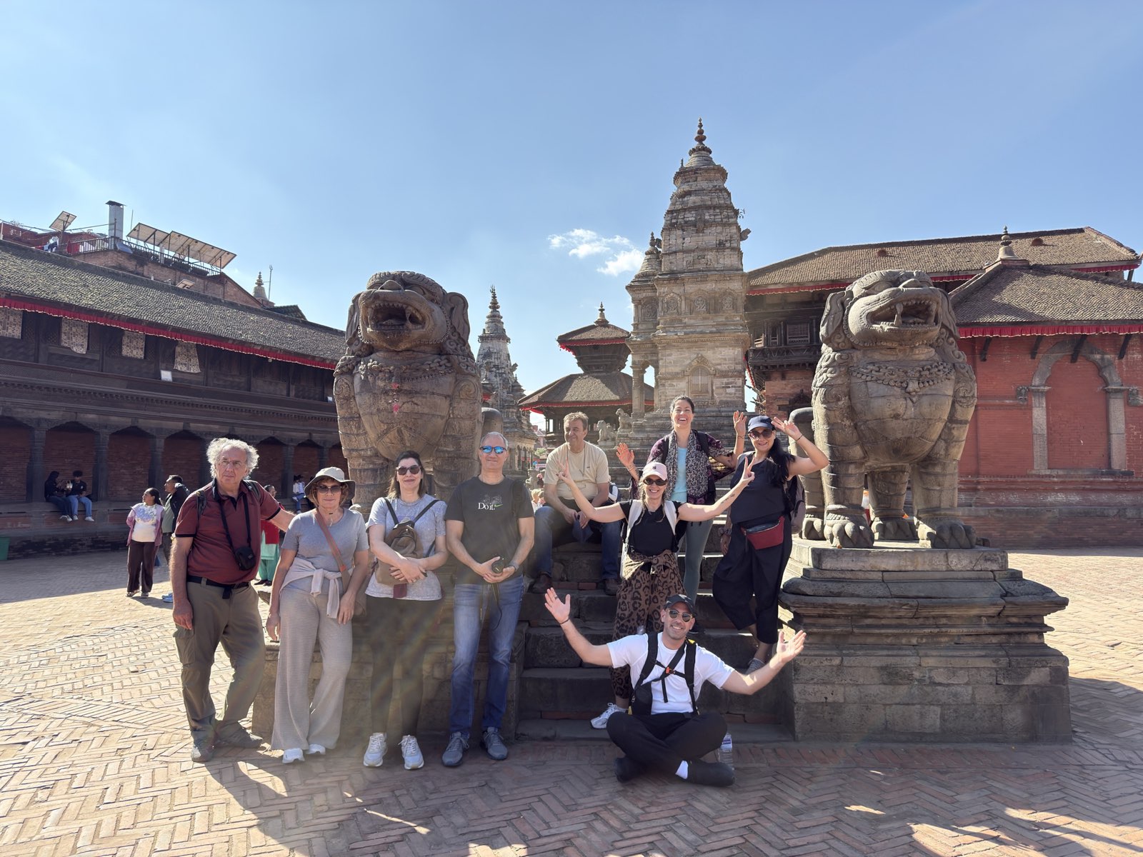
What is open and what is closed (16 October 2026)
| Region | Status |
|---|---|
| Kathmandu, Pokhara, Chitwan National Park | Open. Hotels, monuments, safaris and restaurants operating normally. |
| Everest region (Base Camp, Gokyo) | Open. Trails, lodges and flights to Lukla operating normally. |
| Annapurna region (Base Camp, Circuit, Poon Hill) | Open. Thorong La reopened after the early-October snow and the Circuit is busy again, with 150–200 trekkers a day at Dharapani. The road to Manang is damaged near Chame; the trail itself is passable. |
| Manaslu Circuit, Tsum Valley | Damaged since 11 October. The Budhi Gandaki flood took bridges and sections of trail between Machhakhola and Jagat and at Salleri, and more than 100 foreign trekkers were briefly stranded. MCAP has suspended Tsum Valley until further notice; the section from Philim towards Larke Pass is reported open. We are not confirming Manaslu departures until the lower trail is repaired. |
| Domestic flights | Normal. Late-night flights have been added for Dashain. |
| Kathmandu–Pokhara road (Prithvi Highway) | Open, with care. Two-way traffic resumed at Krishnabhir on 17 September, on a new track cut higher up the slope. On 9 October another stretch subsided at Galaundi, near Gajuri, where the Trishuli had undercut the road in August; it reopened within two days, with overnight closures for repairs. Dashain traffic is several times heavier than normal. Travel by day. |
| Langtang Valley, Gosaikunda | Gradually reopening, not yet normal. Since 11 October a Bailey bridge at Betrawati has reconnected Rasuwa to Nuwakot by road; the bridge at Syabrubesi is still to come. Residents have repaired the Langtang trail themselves, and local operators now start the trek from Thulo Syabru, by jeep via Dhunche. I have not found an official reopening announcement. We plan it case by case. |
| Banks of the Bhote Koshi and Trishuli in Rasuwa | Disaster zone. Reconstruction continues. Not a destination. |
| Land crossings to Tibet (Rasuwagadhi, Tatopani) | Closed. Only Korala, in Mustang, is working, and only for freight — not for tourist crossings. I have found nothing newer. |
Sources for the table: the NDRRMA, the Department of Roads, MCAP, the Kathmandu Post, The Himalayan Times and on-the-ground updates, checked 16 October. Before you travel, ask us. We generally know which road reopened yesterday, because someone we work with drove it.
How we travel Nepal right now
Very little of what we design changes this autumn. What changes is the margin we build into it.
- We keep away from the Bhote Koshi and Trishuli corridors. They are still a disaster zone. Langtang and Gosaikunda go back into an itinerary only case by case, with a local operator who has driven the road that week.
- A doubtful Langtang or Manaslu becomes an Annapurna or an Everest — with the same guide. This is the single most useful substitution available. The guides of both valleys have lost much of their season. Move the journey, keep the person.
- We still prefer to fly Kathmandu to Pokhara. The Prithvi Highway is open again, but stretches of it are still giving way where the Trishuli undercut them, and Dashain triples the traffic. The flight is twenty-five minutes, which is one of the reasons our Premium journeys lean on domestic aviation even in ordinary years.
- Where a road is questionable, we use a helicopter, because it removes a variable. This is the machinery behind our Ultimate journeys.
- Every traveller carries insurance with helicopter evacuation and high-altitude cover. We insist on this in a normal year. This year it is not negotiable.
- Licensed guides and local operators only. Mandatory in Nepal since 2023, and now a safety matter as well: the guides are the people who know which trails moved.
- October and November remain the finest weeks of the Nepali year. The monsoon clears, the air washes out, the trails dry. Nothing about the disaster in Rasuwa has changed that, as our guide to the seasons explains in full.
How to help today
If you cannot travel, or you want to do something before you do, the guidance from everyone working on the ground is consistent. Send money rather than goods — a parcel of clothing costs more to land here than the clothing is worth — and send it only through official channels. In the first seventy-two hours after any disaster, the internet fills with appeals that lead nowhere.
- Prime Minister's Disaster Relief Fund — the Nepali government's own fund. Its founding law confines spending to rescue, treatment, relief and rebuilding, keeps administration out of it, and puts the books through an annual audit.
- Nepal Red Cross Society — present since the first hour, running evacuations, joining the search and standing up the shelters.
- IFRC and CARE — international organisations with active missions in the affected districts.
If you would rather your help landed closer to particular people, write to us and I will tell you what I know at first hand.
How to help this autumn
Come.
Nepal in October and November is the clearest, most generous version of itself, and this year it will be quieter than it should be. If you would like it designed properly, with local guides and with money that stays in the valleys it is earned in, begin here. If you would like to understand who is behind that and why a Greek is writing to you from Pokhara at all, the story is on the founder page.
And if you do not travel with us, travel with someone. Book a Nepali operator, any Nepali operator. The point is not who takes you. The point is that you come.
Questions travellers are asking
Is it safe to travel to Nepal in October and November 2026?
Yes, for most of the country. Kathmandu, Pokhara, Chitwan and the Everest and Annapurna regions are operating normally, and the road between Kathmandu and Pokhara is open. The exceptions are the banks of the Trishuli and Bhote Koshi, Langtang, which is only gradually reopening, and Manaslu, which was hit by a new flood on 11 October. Autumn remains the best season of the Nepali year, with clear skies and dry trails.
Which parts of Nepal are actually closed?
The banks of the Bhote Koshi and Trishuli in Rasuwa remain a disaster zone, and the road to Rasuwagadhi and the Tibetan crossings has not been restored. Langtang is gradually reopening from Thulo Syabru, without an official announcement yet. On Manaslu, the Tsum Valley is suspended and the lower trail is damaged after the flood of 11 October. This is accurate as of 16 October 2026 and is kept up to date.
Were Everest Base Camp and Annapurna affected?
No. They lie in different mountain ranges, many tens of kilometres from Rasuwa, on entirely separate river systems. Trails, lodges and the flights to Lukla and Pokhara are running normally. Manaslu is a different case: a separate flood on the Budhi Gandaki damaged its lower trail on 11 October.
Are Kathmandu airport and the domestic flights running?
Yes. Tribhuvan International Airport is operating without interruption, as are the domestic services to Pokhara, Lukla, Bharatpur and the rest of the network.
How do I get from Kathmandu to Pokhara at the moment?
By air in twenty-five minutes, which is still what we recommend, or by road. The Prithvi Highway reopened to two-way traffic at Krishnabhir on 17 September. A new subsidence at Galaundi on 9 October closed it for about two days, and repairs there continue with overnight closures. If you drive, drive by day, and call Traffic Police on 103 before setting off.
I had booked Langtang. What should I do now?
Ask us first. Since 11 October the road reaches Rasuwa again over a Bailey bridge at Betrawati, residents have repaired the trail, and local operators start the trek from Thulo Syabru instead of Syabrubesi. There is no official reopening announcement yet, so we plan it case by case. If you would rather have certainty, move it to Annapurna or Everest and keep the same guide.
In the Greek press
Since 26 August I have spoken to a number of Greek outlets. They are gathered here for anyone who wants the account from the beginning. All of them are in Greek.
Naftemporiki — video interview. The fullest account I gave in the days after the flood.
- ERT News, 27 August — "An entire mountain left, it turned into water and it took everything"
- CNN Greece, 26 August, carrying the Alpha TV interview — "Here they are talking about thousands of dead, there is no Greek on the list"
- Proto Thema, 26 August — "What happened was terrifying"
- Newsbomb, 26 August — "A dam broke, like an iceberg, villages and towns were destroyed"
- in.gr, 27 August
- Efimerida ton Syntakton, 27 August
- VoiceNews, video — "We are talking about thousands of dead"
- SKAI, September 2025, video — on the Gen Z unrest in Nepal, one year earlier
- Meet Your Host: From Berklee to the Himalayas, video — who I am and how I came to be here
Sources
Update of 16 October:
- Kathmandu Post, 15 Oct: NDRRMA figures on the dead and missing, and how the missing will be verified
- Wikipedia: 2026 Nepal–Tibet floods, consolidated toll based on official announcements (4 Oct)
- UN News / UNICEF, 9 Oct: six weeks on, 84 children among the dead
- Kathmandu Post, 17 Sep: Krishnabhir reopens to two-way traffic
- Nepal Press, 17 Sep: two-way traffic resumes at Krishnabhir after 18 days
- Kathmandu Post, 1 Oct: roads reopen; Manang and Mustang links still cut
- Kathmandu Post, 10 Oct: Galaundi subsidence, Dashain travel and late-night flights
- Kathmandu Post, 12 Oct: overnight closure at Galaudi for repairs
- The Himalayan Times, 16 Oct: the Dashain exodus and the damaged highways
- Kathmandu Post, 11 Oct: Bailey bridge at Betrawati restores the Rasuwa–Nuwakot road link
- Meroauto, 11 Oct: the Betrawati Bailey bridge comes into operation
- Sagarmatha TV (in Nepali): residents repair the Langtang trail themselves
- Local trekking agency, 8 Oct: Langtang now starts from Thulo Syabru (agency update, not an official source)
- The Himalayan Times, 11 Oct: five missing after the Budhi Gandaki flood (NDRRMA)
- The Himalayan Times, 13 Oct: NDRRMA technical assessment of the Gorkha flood
- Al Jazeera, 13 Oct: more than 100 foreign trekkers stranded on the Manaslu trail
- The Tourism Times, 12 Oct: MCAP suspends Tsum Valley, Manaslu trail damaged
- Kathmandu Post, 14 Oct: the flood cuts off northern Gorkha and disrupts the Manaslu season
- Explorersweb, 13 Oct: new flash floods disrupt trekking routes; Thorong La reopens
- IANS / The Himalayan Times, 12 Oct: the Annapurna Circuit rebounds, 150–200 trekkers a day at Dharapani
Original sources, 26 August – 5 September:
- Kathmandu Post, 5 September: the Nepal Police tally on Saturday morning
- Khabarhub, 5 September: Nepal Police update on the dead, the missing and foreign nationals
- Kathmandu Post, 4 September: NDRRMA tally of the dead, the missing and infrastructure damage
- Radio Nepal, 3 September: official toll update
- Kathmandu Post, 4 September: the Department of Roads begins cutting the temporary track at Krishnabhir
- The Himalayan Times, 4 September: 350-metre track at Krishnabhir, seven-to-ten-day estimate
- Kathmandu Post, 3 September: temporary bypass planned at Krishnabhir
- Radio Nepal, 2 September: Prime Minister Balendra Shah promises Krishnabhir reopening within September
- U.S. Embassy Kathmandu, 2 September: Prithvi Highway blocked at Krishnabhir, Rasuwa road closed, Tribhuvan airport open
- OnlineKhabar, 28 August: alternative route to Dhunche for light four-wheel-drive vehicles only
- Nepal News, 31 August: Prithvi Highway closure and Nepal Police advice against non-essential travel
- Wikipedia: 2026 Nepal floods, consolidated toll based on the announcements of the authorities (5 September)
- World Health Organization, Nepal: 2026 Rasuwa flash floods
- Ministry of Home Affairs of Nepal: official appeal for assistance
- Kathmandu Post, 28 August: Nepal tourism faces another setback
- Kathmandu Post, 27 August: How people can help
- The Longest Way Home: Nepal floods 2026, what travellers need to know (4 September)
Photographs: Dimitrios Giannopoulos, unless otherwise stated. Hero photograph, the Langtang range with Langtang Lirung: Bibek010, Wikimedia Commons, CC BY-SA 4.0. Satellite imagery: ESA, Copernicus Sentinel-2 (CC BY 4.0) and USGS, Landsat 9 (public domain), both via Wikimedia Commons.